

Initial Laser SLAM mapping is one of the first technical steps when deploying an autonomous forklift in a large warehouse.
For a large facility, however, the mapping process should not be measured only by the time required to drive the AGV around the building.
The complete process normally includes site preparation, map collection, map processing, route configuration, positioning verification and operational testing.
This means that a warehouse manager should ask:How long will it take to create a usable production map?rather than simply asking how many hours the robot needs to scan the building.
There is no reliable universal mapping time based only on warehouse size.
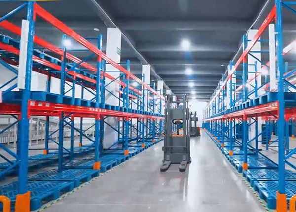
A 50,000 sq ft warehouse with a simple open layout may be considerably faster to map than a smaller facility containing dense racks, narrow aisles, offices, columns, temporary storage and heavy forklift traffic.
The actual mapping time depends on factors such as:
Actual navigable floor area
Number and length of aisles
Rack density
Number of intersections
Columns and fixed structures
Temporary obstacles
People and forklift traffic
Required map resolution
Navigation technology and sensor configuration
Whether one or multiple floors are involved
For this reason, suppliers should provide a project-specific estimate after reviewing the warehouse layout instead of promising a fixed number of hours based only on square footage.
For a large facility, the mapping drive itself may be relatively short compared with the subsequent work required to validate routes, define operating zones and test vehicle localization.
A professional AGV deployment normally separates mapping from navigation configuration.
The process may include:
Inspecting the warehouse environment
Preparing the operating area
Driving the AGV through the required areas
Collecting LiDAR data
Creating or processing the SLAM map
Checking localization quality
Defining lanes and navigation paths
Creating pickup and drop-off points
Defining restricted zones
Configuring speed limits
Testing representative routes
The final step is important because a visually correct map is not automatically a production-ready navigation configuration.
Normally, you do not need to empty an entire warehouse before creating a Laser SLAM map.
In fact, permanent warehouse structures are often useful navigation references.
Fixed features such as:
Rack frames
Columns
Walls
Guardrails
Building structures
can provide stable environmental features for laser-based localization.
The bigger concern is temporary objects that may move between the mapping session and normal operation.
Examples include pallets left in travel lanes, parked forklifts, temporary storage racks, waste containers and construction materials.
The goal is therefore not to make the warehouse completely empty. The goal is to ensure that the map contains reliable environmental features and that temporary obstacles are not incorrectly treated as permanent structures.
It depends on the facility and the navigation system.
A busy warehouse can be mapped while operating, but heavy traffic can make the process more difficult because moving forklifts, pedestrians and temporary pallets introduce changing environmental information.
For the initial map, many projects prefer a controlled period with reduced traffic.
This does not necessarily mean shutting down the entire warehouse. A designated mapping window can often be sufficient.
Sometimes, but buyers should not assume that every Chinese AGV fleet-management system can directly use an AutoCAD drawing as its navigation map.
AutoCAD drawings and SLAM maps serve different purposes.
An engineering drawing normally describes building geometry, racks, walls and other planned structures. A SLAM navigation map represents the sensor-observed environment used by the robot for localization and navigation.
Depending on the supplier, CAD information may be used as:
A layout reference
A coordinate planning reference
A basis for creating navigation paths
A source for rack and station locations
A background layer for fleet-management software
Some systems may support specific CAD formats or conversion workflows, while others require the AGV to create its own sensor-based map first.
Before purchasing the system, ask the supplier specifically whether DWG or DXF files can be imported, what coordinate system is required, and whether the imported drawing becomes a navigation map or only a visual reference.
A warehouse drawing represents the designed environment. The AGV needs to understand the environment that actually exists.
There can be significant differences between the two.
For example, a CAD drawing may show a rack in its planned position while the physical rack has been moved several inches. A drawing may also contain walls or structures that have been removed during a renovation.
This is why sensor-based mapping and physical verification remain important even when accurate CAD drawings are available.
A new mezzanine office, partition or other permanent structure can change the environment used by the AGV's localization system.
The effect depends on where the new structure is located and how much of the existing navigation environment it changes.
A small change outside the main travel routes may have little practical effect. A large structure near important navigation references may require map modification or partial remapping.
The correct response should therefore be based on testing rather than automatically rebuilding the entire warehouse map.
Not necessarily.
Many warehouse changes can be handled through localized map updates or configuration changes, depending on the fleet software.
Examples include:
Adding a new office
Moving a small number of racks
Changing a staging area
Closing an aisle
Creating a restricted zone
Changing a pickup or drop-off point
However, extensive construction can justify a new mapping session.
The supplier should determine whether the change affects only the navigation route, the map geometry, localization references or the entire operating environment.
The important issue is not simply whether the mezzanine appears on the map.
The question is whether the new structure changes the stable environmental features used by the Laser SLAM system for localization.
If the new structure creates additional walls, columns or large surfaces near an existing route, the sensor environment can become different from the original map.
A supplier may therefore need to:
Update the affected map area
Recheck localization
Validate nearby routes
Reconfigure restricted areas
Run test missions before returning the area to production
Not every warehouse change has the same impact.
| Warehouse Change | Potential AGV Impact |
|---|---|
| Moving a pallet | Usually temporary obstacle handling |
| Moving a rack | May require route or map updates |
| Adding a permanent wall | May affect the local map and localization |
| Adding a mezzanine office | Requires validation around the modified area |
| Changing aisle layout | Usually requires route reconfiguration |
| Major warehouse reconstruction | May require extensive remapping |
For a large facility, mapping should be treated as an engineering activity rather than a simple robot setup task.
Before the supplier arrives, prepare:
Current warehouse layout
Rack drawings
Aisle dimensions
Restricted areas
Pickup and drop-off locations
Charging locations
Elevator or door interfaces
Pedestrian areas
Future construction plans
If a warehouse renovation is already planned, complete the major physical changes before creating the final production map whenever possible.
This avoids paying for repeated mapping and route configuration.
The map should not be accepted simply because the AGV can drive around the warehouse.
A useful commissioning test should include:
Repeated localization checks
Representative long-distance routes
Narrow-aisle navigation
Pickup and drop-off operations
Intersections
Charging areas
Temporary obstacles
Pedestrian interaction zones
Emergency-stop recovery
The purpose is to verify that the navigation map works under realistic warehouse conditions rather than only under the controlled conditions used during mapping.
Before purchasing a Chinese autonomous forklift, ask the supplier several specific questions.
How is the initial map created?
Can the supplier map the warehouse remotely or only on site?
Can existing CAD drawings be imported?
Which DWG or DXF versions are supported?
Can maps be edited after deployment?
Can individual areas be remapped without rebuilding the entire map?
How are permanent obstacles distinguished from temporary obstacles?
How are future warehouse renovations handled?
Can the original map be backed up and restored?
What happens if localization quality changes after a building modification?
For a 50,000 sq ft warehouse, it is tempting to compare suppliers by asking which AGV can finish mapping the building fastest.
That is not necessarily the best purchasing criterion.
A map that is created quickly but requires frequent intervention after racks, offices or warehouse processes change can create more operational cost than a slightly longer commissioning process.
When evaluating Chinese AGVs, look at the complete mapping lifecycle:
Initial Mapping → Route Configuration → Validation → Map Backup → Local Changes → Remapping → Regression Testing
The best system is not necessarily the one that produces a map in the fewest hours. It is the one that gives the warehouse team a practical way to maintain reliable navigation as the facility changes.
FREE ENGINEERING SUPPORT Stop Gambling on Generic Platforms. Get an AGV/AMR Tailored to Your Warehouse.Buying automated guided vehicles involves complex safety standards (CE/ANSI), navigation setups (Laser SLAM), and ERP system integration. Don't risk your factory safety with middle-men. ✓ 100% Direct Factory: Customized payload up to 5 Tons. ✓ Free CAD Simulation: Send us your layout, and our engineers will simulate the optimal AGV routes. ✓ Global Support: Overseas installation guidance & local maintenance partners. |





 Chinese
 English